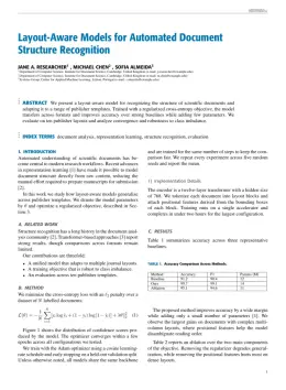
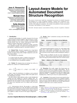
IEEE

IEEE Geoscience and Remote Sensing Magazine Template

Write in a clean editor, then format for IEEE Geoscience and Remote Sensing Magazine in one click — DocuGuru applies the official IEEE template with numbered references and exports a submission-ready PDF plus the editable LaTeX source. Free to start.

About the IEEE Geoscience and Remote Sensing Magazine format

IEEE Geoscience and Remote Sensing Magazine is a peer-reviewed journal published by IEEE, covering Diverse Scientific and Economic Studies, Remote-Sensing Image Classification, Human auditory perception and evaluation. Over its lifetime it has published 1,323 papers, which have received 37,185 citations.

PublisherIEEE
Reference styleNumbered (IEEE)
Numbered — [1], [2] in the text
[1] A. Smith, B. Jones, and C. Lee, "A representative article title," IEEE Geoscience and Remote Sensing Magazine, vol. 12, no. 3, pp. 45–58, 2023.

Formats any DOI in IEEE Geoscience and Remote Sensing Magazine style. No sign-up.

Abbreviation (ISO-4)GRSM
Publishes research inDiverse Scientific and Economic Studies Remote-Sensing Image Classification Human auditory perception and evaluation Synthetic Aperture Radar (SAR) Applications and Techniques Educational Robotics and Engineering
ISSN2168-6831
Citation impact (2-yr)5.9
h-index83
i10-index263
Top institutions publishing hereDeutsches Zentrum für Luft- und Raumfahrt e. V. (DLR)
Journal websiteieeexplore.ieee.org
You getA submission-ready PDF and the editable LaTeX source — ready to submit.

Papers published in IEEE Geoscience and Remote Sensing Magazine per year

116
2014
96
2015
96
2016
84
2017
87
2018
73
2019
87
2020
91
2021
78
2022
81
2023
112
2024
129
2025

Citation impact of IEEE Geoscience and Remote Sensing Magazine by publication year

1.2K
2014
1.7K
2015
3.8K
2016
5.7K
2017
1.2K
2018
4K
2019
3.6K
2020
3.9K
2021
2.9K
2022
1.1K
2023
1.3K
2024
592
2025

Citations each year’s papers have accumulated so far — the most recent years are still building up.

Most-cited papers in IEEE Geoscience and Remote Sensing Magazine

Deep Learning in Remote Sensing: A Comprehensive Review and List of Resources

Xiao Xiang Zhu, Devis Tuia, Lichao Mou et al. · 1 Dec 2017

Central to the looming paradigm shift toward data-intensive science, machine-learning techniques are becoming increasingly important. In particular, deep learning has proven to be both a major breakthrough and an extremely powerful tool in many fields. Shall we embrace deep learning as the key to everything? Or should we resist a black-box solution? These are controversial…

3,048 citations Cite SaveGo to paper →
A tutorial on synthetic aperture radar

Alberto Moreira, Pau Prats, Marwan Younis et al. · 1 Mar 2013

Synthetic Aperture Radar (SAR) has been widely used for Earth remote sensing for more than 30 years. It provides high-resolution, day-and-night and weather-independent images for a multitude of applications ranging from geoscience and climate change research, environmental and Earth system monitoring, 2-D and 3-D mapping, change detection, 4-D mapping (space and time), security-related applications up…

2,698 citations Cite SaveGo to paper →
Deep Learning for Remote Sensing Data: A Technical Tutorial on the State of the Art

Liangpei Zhang, Lefei Zhang, Bo Du · 1 Jun 2016

Deep-learning (DL) algorithms, which learn the representative and discriminative features in a hierarchical manner from the data, have recently become a hotspot in the machine-learning area and have been introduced into the geoscience and remote sensing (RS) community for RS big data analysis. Considering the low-level features (e.g., spectral and texture) as the bottom level,…

2,197 citations Cite SaveGo to paper →
Hyperspectral Remote Sensing Data Analysis and Future Challenges

José M. Bioucas‐Dias, Antonio Plaza, Gustau Camps‐Valls et al. · 1 Jun 2013

Hyperspectral remote sensing technology has advanced significantly in the past two decades. Current sensors onboard airborne and spaceborne platforms cover large areas of the Earth surface with unprecedented spectral, spatial, and temporal resolutions. These characteristics enable a myriad of applications requiring fine identification of materials or estimation of physical parameters. Very often, these applications rely…

2,109 citations Cite SaveGo to paper →
Advances in Hyperspectral Image and Signal Processing: A Comprehensive Overview of the State of the Art

Pedram Ghamisi, Naoto Yokoya, Jun Li et al. · 1 Dec 2017

Recent advances in airborne and spaceborne hyperspectral imaging technology have provided end users with rich spectral, spatial, and temporal information. They have made a plethora of applications feasible for the analysis of large areas of the Earth?s surface. However, a significant number of factors-such as the high dimensions and size of the hyperspectral data, the…

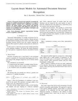
IEEE Geoscience and Remote Sensing Magazine template — frequently asked questions

How do I write a paper in the IEEE Geoscience and Remote Sensing Magazine format?
In DocuGuru you write your manuscript in a normal editor — no LaTeX setup required — and select the IEEE Geoscience and Remote Sensing Magazine template. When you export, DocuGuru compiles the paper into the official IEEE format and hands you a submission-ready PDF along with the editable LaTeX source.
What reference style does IEEE Geoscience and Remote Sensing Magazine use?
IEEE Geoscience and Remote Sensing Magazine uses Numbered (IEEE) references, shown as numbered [1], [2] markers in the text. DocuGuru formats every in-text citation and the reference list in this exact style automatically. A reference appears like this: [1] A. Smith, B. Jones, and C. Lee, "A representative article title," IEEE Geoscience and Remote Sensing Magazine, vol. 12, no. 3, pp. 45–58, 2023.
Do I need to know LaTeX to submit to IEEE Geoscience and Remote Sensing Magazine?
No. DocuGuru generates the IEEEtran LaTeX class and compiles the PDF for you in the background, so you get a IEEE-ready IEEE Geoscience and Remote Sensing Magazine document without writing any LaTeX. If you do want it, the LaTeX source is included in the export.
Can I import an existing draft into the IEEE Geoscience and Remote Sensing Magazine template?
Yes. Paste or upload your current manuscript — Word, LaTeX, Markdown, or plain text — and DocuGuru reflows it into the IEEE Geoscience and Remote Sensing Magazine format with correct headings, figures, tables, and numbered citations.
Who publishes IEEE Geoscience and Remote Sensing Magazine?
IEEE Geoscience and Remote Sensing Magazine is a engineering and computer science journal published by IEEE. DocuGuru's IEEE Geoscience and Remote Sensing Magazine template matches IEEE's official submission format.
Can I export a submission-ready IEEE Geoscience and Remote Sensing Magazine PDF?
Yes — DocuGuru produces a PDF built with the official IEEE Geoscience and Remote Sensing Magazine template (the IEEEtran class) that is ready to submit to IEEE, together with the matching LaTeX source files.
How much does the IEEE Geoscience and Remote Sensing Magazine template cost?
You can start writing in the IEEE Geoscience and Remote Sensing Magazine template for free. Exporting the final submission-ready IEEE Geoscience and Remote Sensing Magazine PDF and LaTeX source is part of DocuGuru's paid plans — see the app for current pricing.
Use the IEEE Geoscience and Remote Sensing Magazine template