IEEE

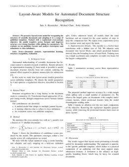
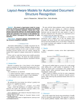
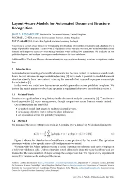
IEEE Transactions on Geoscience and Remote Sensing Template

Write in a clean editor, then format for IEEE Transactions on Geoscience and Remote Sensing in one click — DocuGuru applies the official IEEE template with numbered references and exports a submission-ready PDF plus the editable LaTeX source. Free to start.

About the IEEE Transactions on Geoscience and Remote Sensing format

IEEE Transactions on Geoscience and Remote Sensing is a peer-reviewed journal published by IEEE, covering Remote-Sensing Image Classification, Synthetic Aperture Radar (SAR) Applications and Techniques, Soil Moisture and Remote Sensing. Over its lifetime it has published 27,045 papers, which have received 1,186,157 citations.

PublisherIEEE
Reference styleNumbered (IEEE)
Numbered — [1], [2] in the text
[1] A. Smith, B. Jones, and C. Lee, "A representative article title," IEEE Transactions on Geoscience and Remote Sensing, vol. 12, no. 3, pp. 45–58, 2023.

Formats any DOI in IEEE Transactions on Geoscience and Remote Sensing style. No sign-up.

Abbreviation (ISO-4)TGRS
Publishes research inRemote-Sensing Image Classification Synthetic Aperture Radar (SAR) Applications and Techniques Soil Moisture and Remote Sensing Advanced SAR Imaging Techniques Remote Sensing and Land Use
ISSN0196-2892
Citation impact (2-yr)6.21
h-index382
i10-index15,610
Top institutions publishing hereChinese Academy of Sciences
Journal websiteieeexplore.ieee.org
You getA submission-ready PDF and the editable LaTeX source — ready to submit.

Papers published in IEEE Transactions on Geoscience and Remote Sensing per year

594
2014
544
2015
661
2016
788
2017
713
2018
871
2019
1.2K
2020
1.5K
2021
1.6K
2022
2.2K
2023
2.9K
2024
2.7K
2025

Citation impact of IEEE Transactions on Geoscience and Remote Sensing by publication year

36.1K
2014
29.9K
2015
37.9K
2016
42K
2017
40.8K
2018
45.6K
2019
55.8K
2020
52.9K
2021
49K
2022
50.6K
2023
35.7K
2024
7.7K
2025

Citations each year’s papers have accumulated so far — the most recent years are still building up.

Most-cited papers in IEEE Transactions on Geoscience and Remote Sensing

Permanent scatterers in SAR interferometry

A. Ferretti, C. Prati, F. Rocca · 1 Jan 2001

Temporal and geometrical decorrelation often prevents SAR interferometry from being an operational tool for surface deformation monitoring and topographic profile reconstruction. Moreover, atmospheric disturbances can strongly compromise the accuracy of the results. The authors present a complete procedure for the identification and exploitation of stable natural reflectors or permanent scatterers (PSs) starting from long temporal…

5,429 citations Cite SaveGo to paper →
A new algorithm for surface deformation monitoring based on small baseline differential SAR interferograms

P. Berardino, G. Fornaro, Riccardo Lanari et al. · 1 Nov 2002

We present a new differential synthetic aperture radar (SAR) interferometry algorithm for monitoring the temporal evolution of surface deformations. The presented technique is based on an appropriate combination of differential interferograms produced by data pairs characterized by a small orbital separation (baseline) in order to limit the spatial decorrelation phenomena. The application of the singular…

5,156 citations Cite SaveGo to paper →
Classification of hyperspectral remote sensing images with support vector machines

Farid Melgani, Lorenzo Bruzzone · 1 Aug 2004

This paper addresses the problem of the classification of hyperspectral remote sensing images by support vector machines (SVMs). First, we propose a theoretical discussion and experimental analysis aimed at understanding and assessing the potentialities of SVM classifiers in hyperdimensional feature spaces. Then, we assess the effectiveness of SVMs with respect to conventional feature-reduction-based approaches and…

4,348 citations Cite SaveGo to paper →
Second Simulation of the Satellite Signal in the Solar Spectrum, 6S: an overview

Éric Vermote, D. Tanré, J. L. Deuzé et al. · 1 May 1997

Remote sensing from satellite or airborne platforms of land or sea surfaces in the visible and near infrared is strongly affected by the presence of the atmosphere along the path from Sun to target (surface) to sensor. This paper presents 6S (Second Simulation of the Satellite Signal in the Solar Spectrum), a computer code which…

3,198 citations Cite SaveGo to paper →
Deep Feature Extraction and Classification of Hyperspectral Images Based on Convolutional Neural Networks

Yushi Chen, Hanlu Jiang, Chunyang Li et al. · 19 Jul 2016

Due to the advantages of deep learning, in this paper, a regularized deep feature extraction (FE) method is presented for hyperspectral image (HSI) classification using a convolutional neural network (CNN). The proposed approach employs several convolutional and pooling layers to extract deep features from HSIs, which are nonlinear, discriminant, and invariant. These features are useful…

2,925 citations Cite SaveGo to paper →

IEEE Transactions on Geoscience and Remote Sensing template — frequently asked questions

How do I write a paper in the IEEE Transactions on Geoscience and Remote Sensing format?
In DocuGuru you write your manuscript in a normal editor — no LaTeX setup required — and select the IEEE Transactions on Geoscience and Remote Sensing template. When you export, DocuGuru compiles the paper into the official IEEE format and hands you a submission-ready PDF along with the editable LaTeX source.
What reference style does IEEE Transactions on Geoscience and Remote Sensing use?
IEEE Transactions on Geoscience and Remote Sensing uses Numbered (IEEE) references, shown as numbered [1], [2] markers in the text. DocuGuru formats every in-text citation and the reference list in this exact style automatically. A reference appears like this: [1] A. Smith, B. Jones, and C. Lee, "A representative article title," IEEE Transactions on Geoscience and Remote Sensing, vol. 12, no. 3, pp. 45–58, 2023.
Do I need to know LaTeX to submit to IEEE Transactions on Geoscience and Remote Sensing?
No. DocuGuru generates the IEEEtran LaTeX class and compiles the PDF for you in the background, so you get a IEEE-ready IEEE Transactions on Geoscience and Remote Sensing document without writing any LaTeX. If you do want it, the LaTeX source is included in the export.
Can I import an existing draft into the IEEE Transactions on Geoscience and Remote Sensing template?
Yes. Paste or upload your current manuscript — Word, LaTeX, Markdown, or plain text — and DocuGuru reflows it into the IEEE Transactions on Geoscience and Remote Sensing format with correct headings, figures, tables, and numbered citations.
Who publishes IEEE Transactions on Geoscience and Remote Sensing?
IEEE Transactions on Geoscience and Remote Sensing is a engineering and computer science journal published by IEEE. DocuGuru's IEEE Transactions on Geoscience and Remote Sensing template matches IEEE's official submission format.
Can I export a submission-ready IEEE Transactions on Geoscience and Remote Sensing PDF?
Yes — DocuGuru produces a PDF built with the official IEEE Transactions on Geoscience and Remote Sensing template (the IEEEtran class) that is ready to submit to IEEE, together with the matching LaTeX source files.
How much does the IEEE Transactions on Geoscience and Remote Sensing template cost?
You can start writing in the IEEE Transactions on Geoscience and Remote Sensing template for free. Exporting the final submission-ready IEEE Transactions on Geoscience and Remote Sensing PDF and LaTeX source is part of DocuGuru's paid plans — see the app for current pricing.
Use the IEEE Transactions on Geoscience and Remote Sensing template